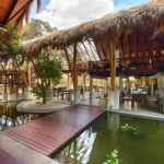
Home
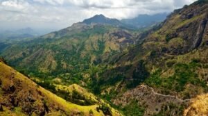
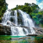
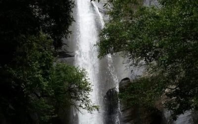
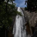
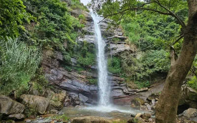
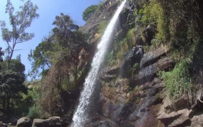
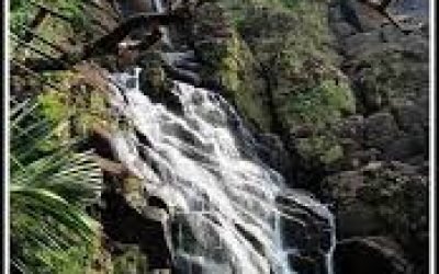
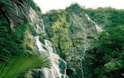
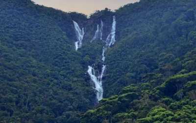
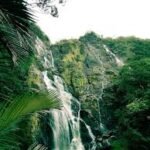
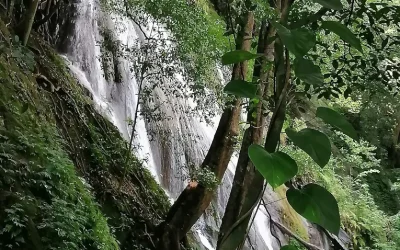
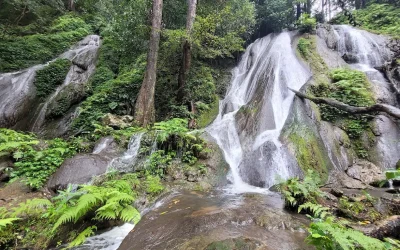
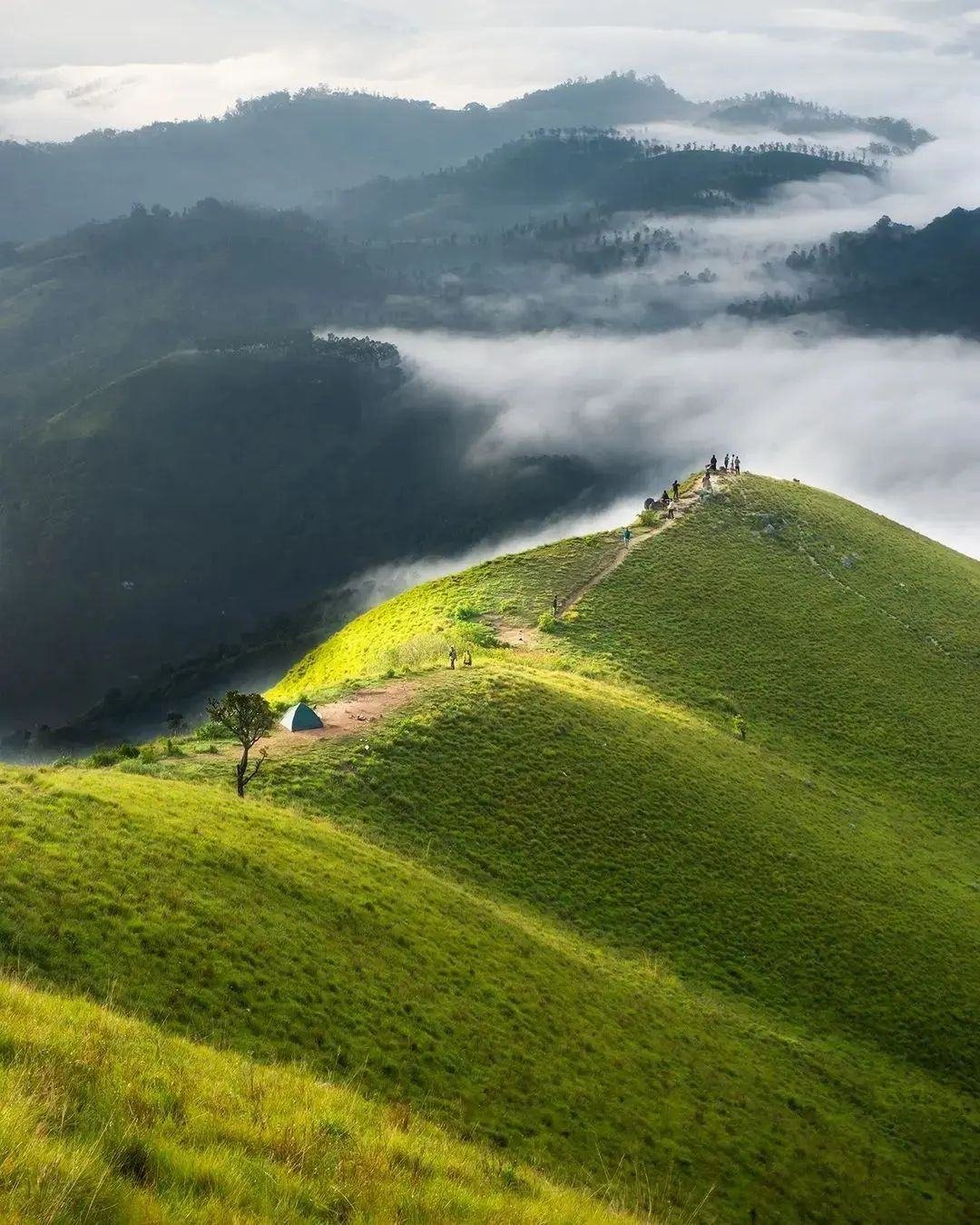
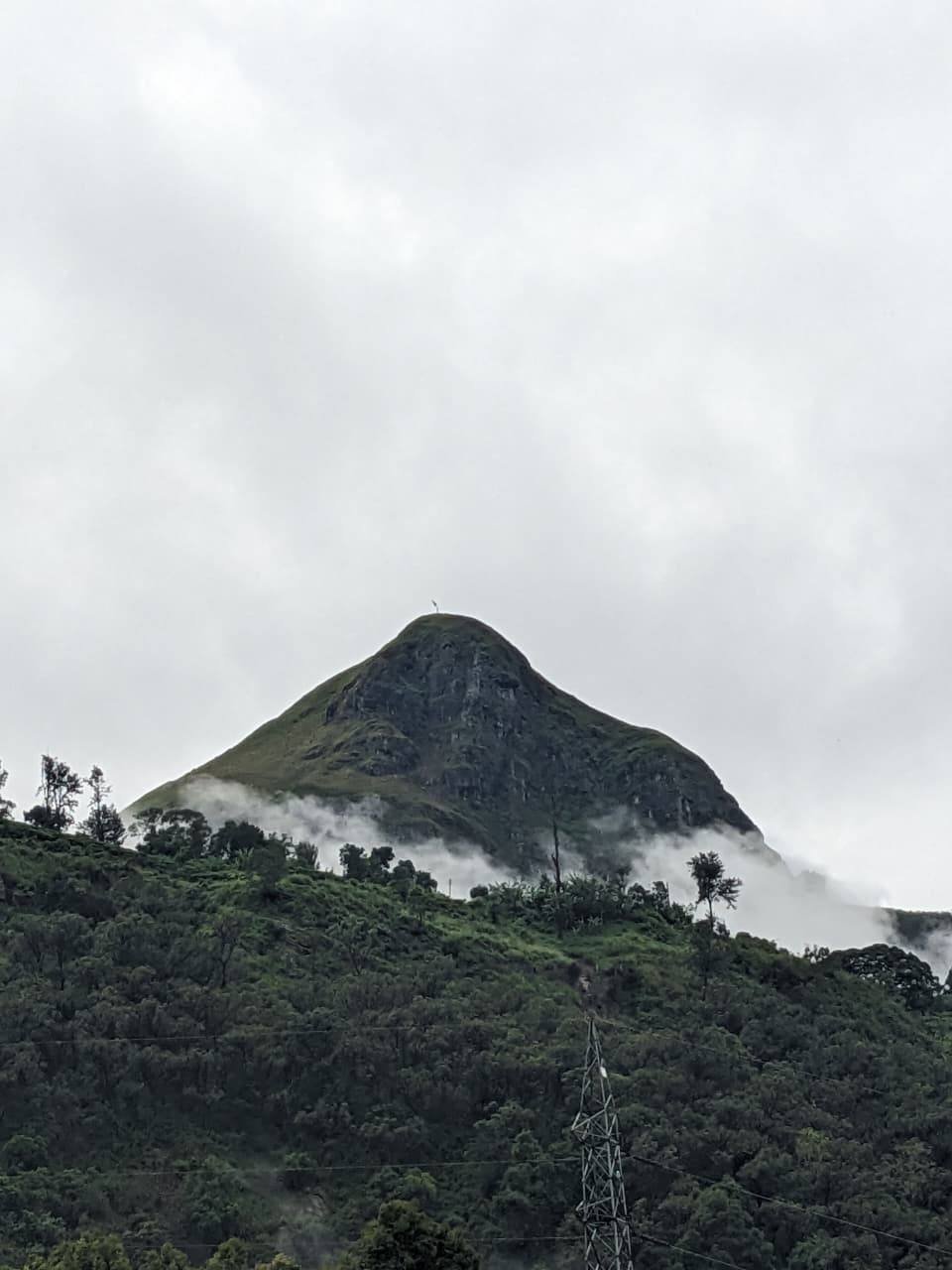
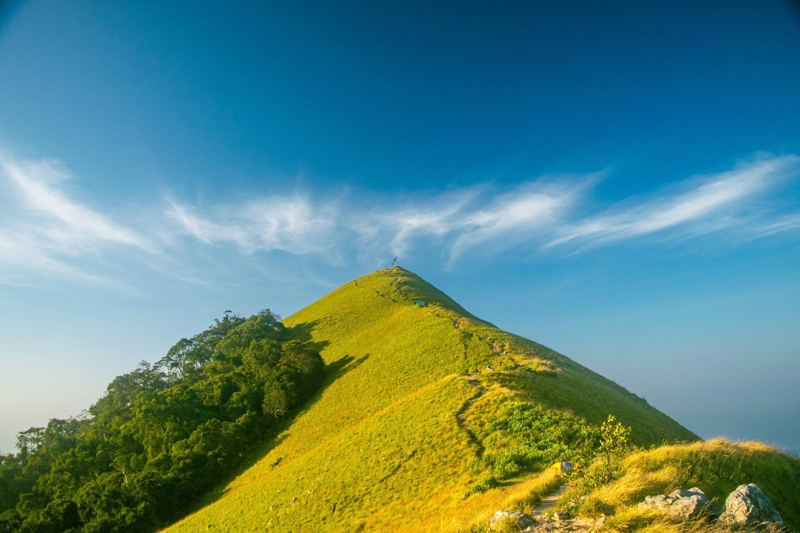
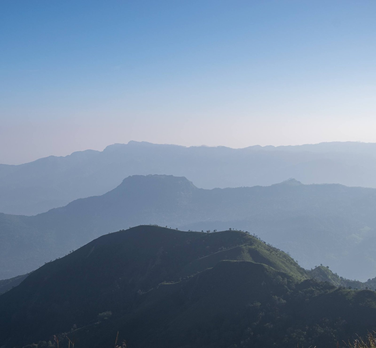
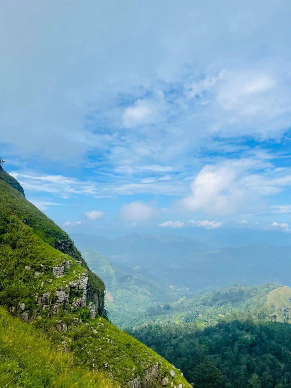
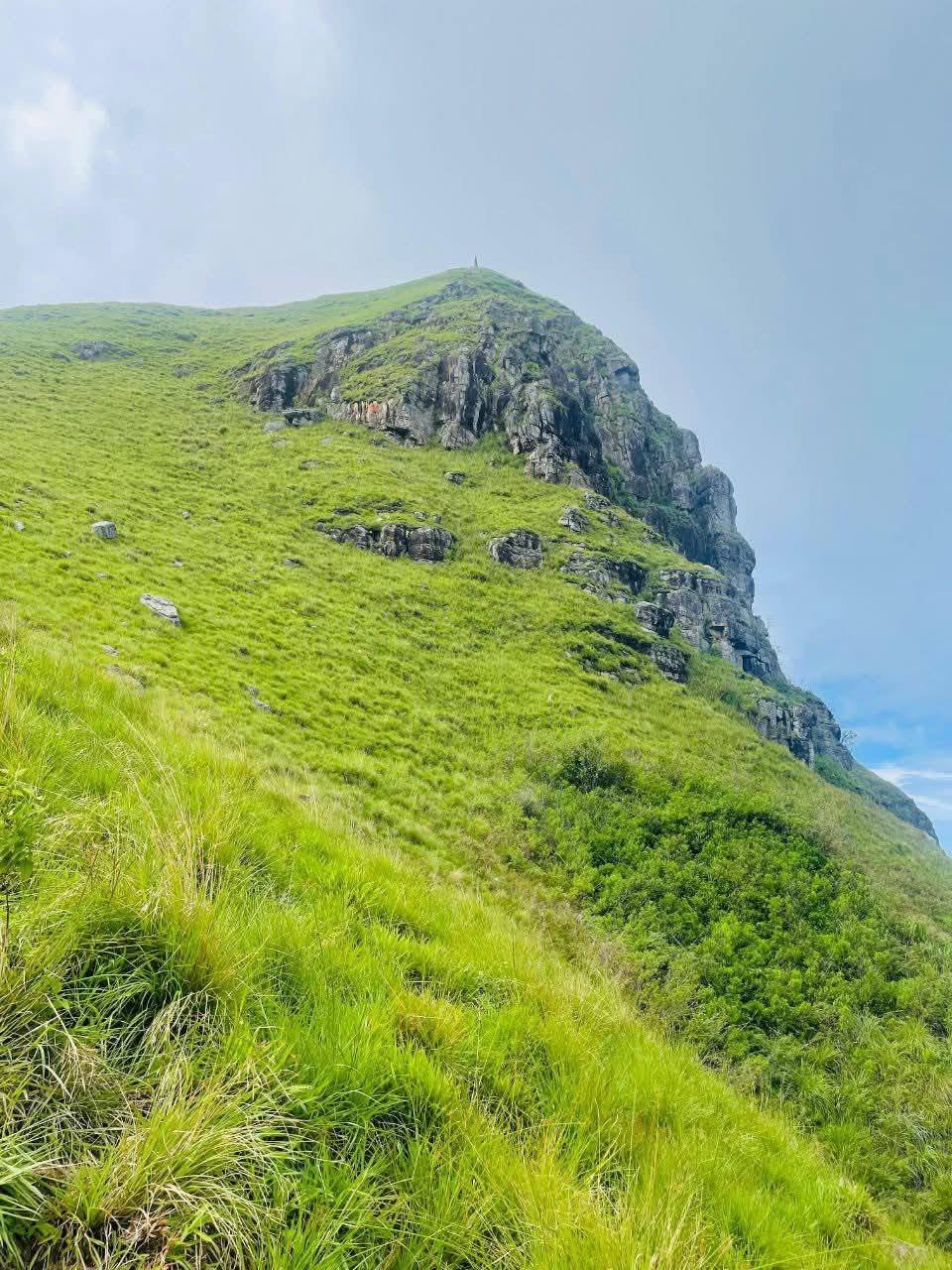
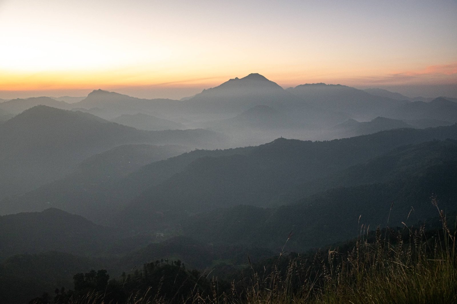
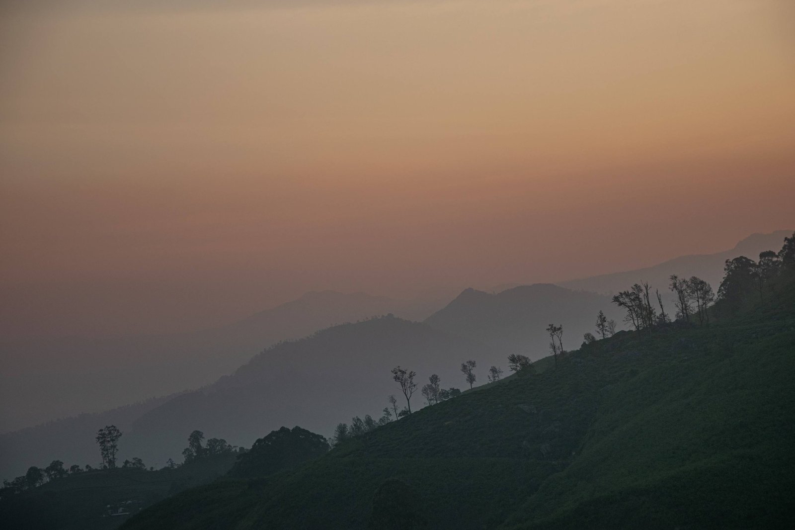
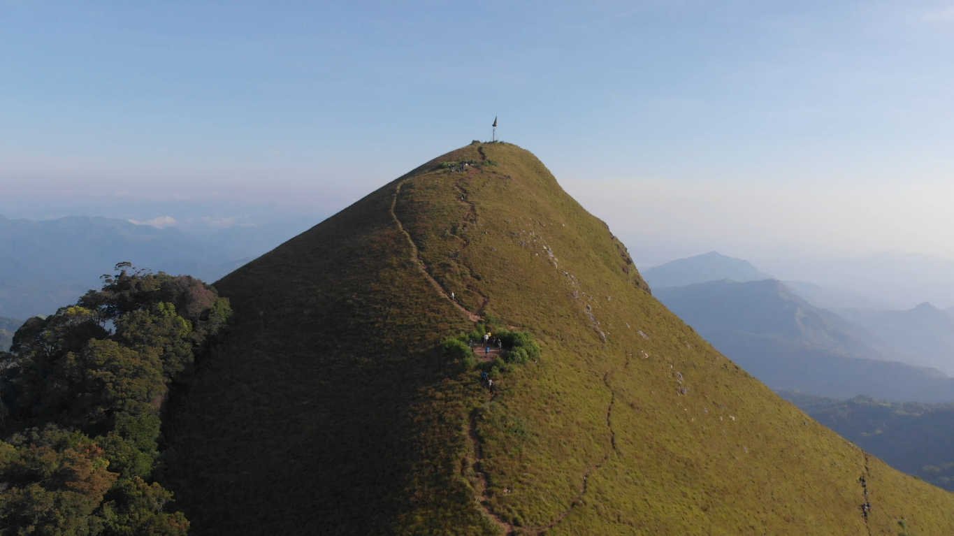
Narangala Mountain is a stunning mountain located in the Badulla district, near a village called Haliela. It is most famous for its beautiful, golden grasslands and its unique, triangular – shaped peak. Standing at about 1,500 meters high. It is one of the best places in the Uva Province to see a “sea of clouds” in the morning. Unlike some tough mountain climbs, Narangala is relatively easy to hike, making it a favorite spot for young travelers and campers who want to see amazing views without an exhausting struggle.
🌟Epic Sunrise: Watching the sun come up over the misty mountains from the peak is a magical experience.
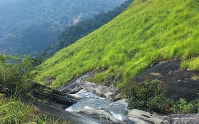
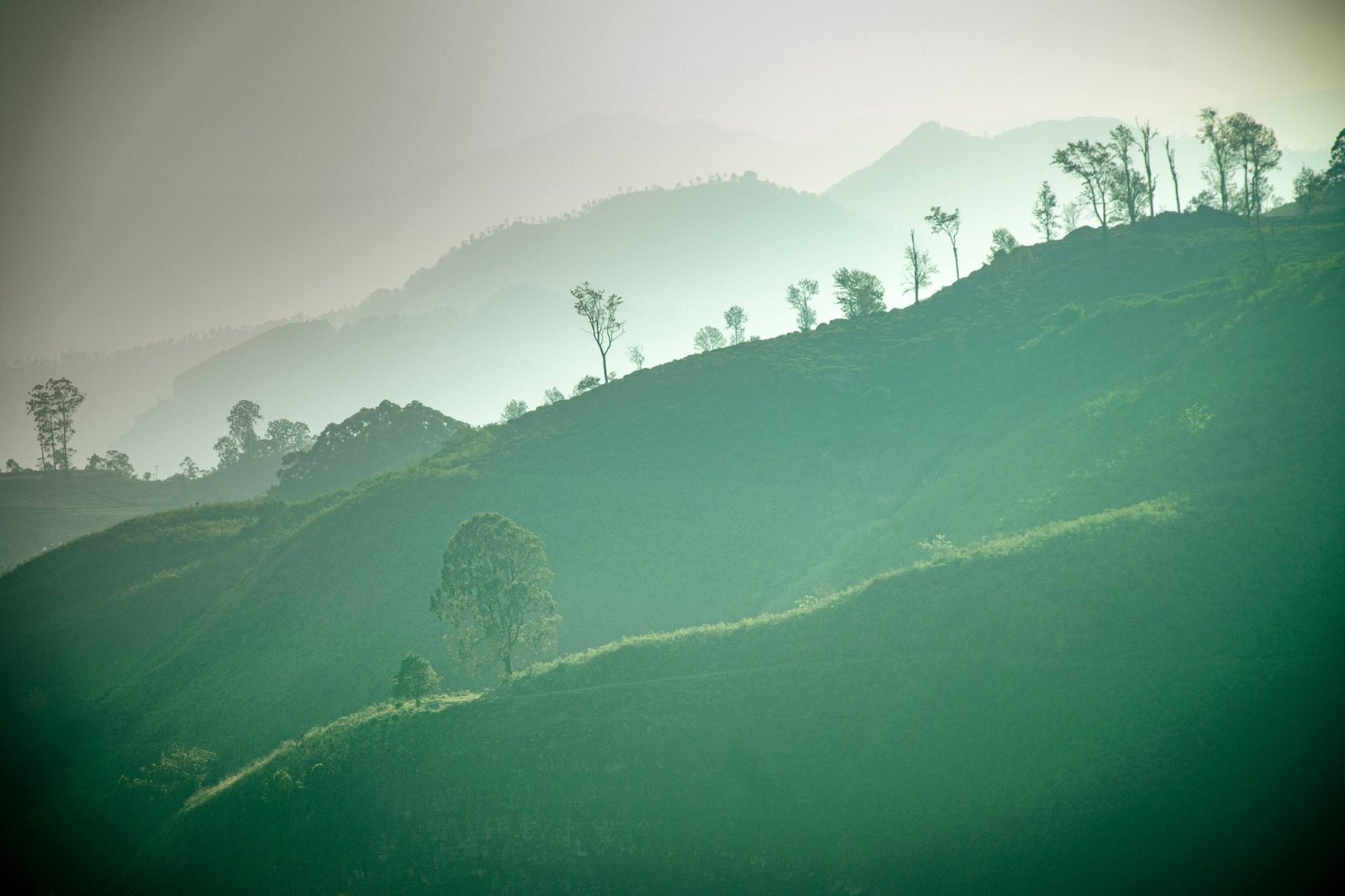
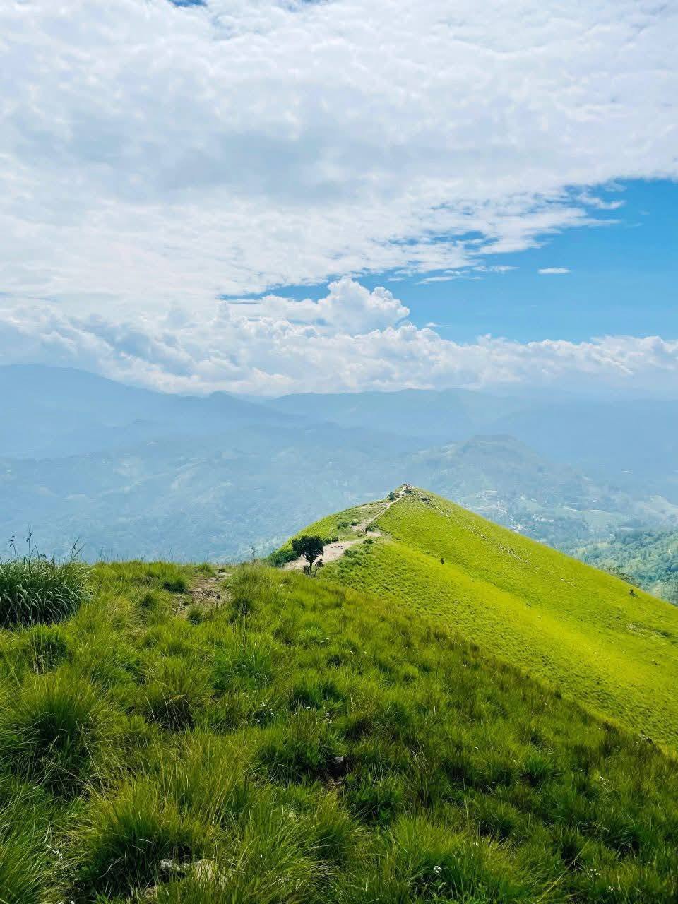
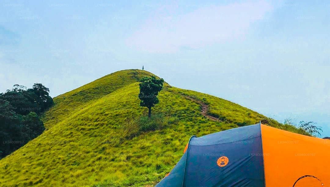
🌟Golden Meadows: The entire mountain is covered in tall “Mana” grass that turns a beautiful golden color in the sunlight.
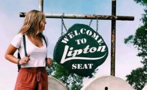
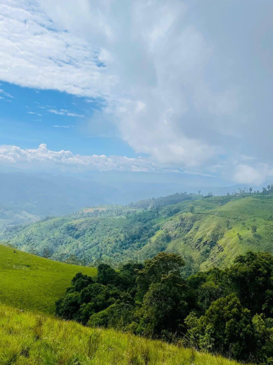
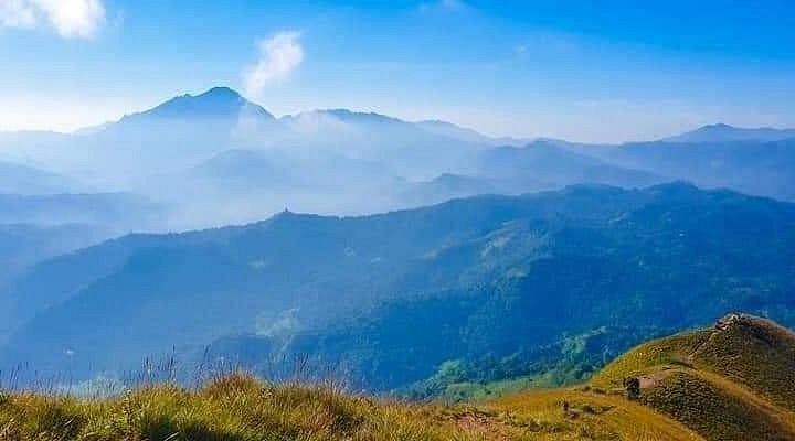
🌟360 – Degree View: From the top, you can see all the way to Namunukula, Ella Rock, and even Lipton’s Seat on a clear day.
🌟Top Camping Spot: It is widely considered one of the best and most scenic places to camp overnight in Sri Lanka.
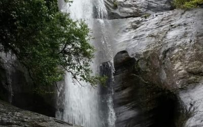
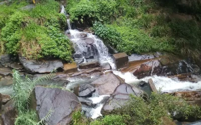
Narangala is actually the second – highest mountain in the Uva region. The mountain has two main peaks. The first one is a large plateau, and the second one is the sharp, pointed peak that looks like a triangle from a distance. Because it is surrounded by tea estates, the air here is incredibly fresh and smells like tea leaves and wildflowers.
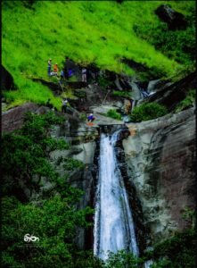
✅Hiking: Enjoy a scenic walk through tea estates and grasslands to reach the summit.
✅Camping: Spend a night under the stars (just make sure you are prepared for the wind!).
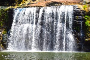
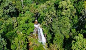
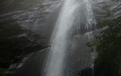
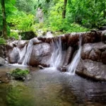
✅Photography: Capture the rolling hills and the dramatic mountain drops.
✅Meditation: The quiet atmosphere and the cool breeze make it a great place to relax your mind.
📍 Starting Point: First, travel to Badulla town or Haliela.
🚗 The Route: From Haliela, head towards the Kehelwatta area.
🛺 Tuk – Tuk: You can take a tuk-tuk from Haliela to the starting point of the trail near the tea factory.
🚶 The Hike: The walk to the top takes about 1 to 1.5 hours depending on your speed. The path is visible and goes through the tea estate first.
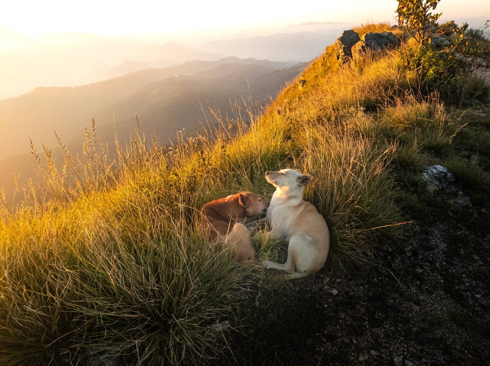
Visiting Narangala feels like walking into a dream. As you climb higher, the houses below look like tiny toys, and the wind starts to get stronger and cooler. When you reach the top, the feeling of freedom is incredible – you are literally standing above the clouds. It’s a mix of adventure, peace, and pure natural beauty that leaves you feeling refreshed.
⚠️High Winds: The wind at the summit can be extremely strong, especially at night. If you are camping, make sure your tent is very secure.
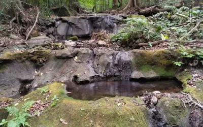
⚠️No Water: There are no water sources at the top. You must carry enough water for drinking and cooking from the bottom.
⚠️Leave No Trace: Please do not leave any plastic, bottles, or food wrappers. Bring all your trash back down with you.
⚠️Leeches: During rainy days, there might be leeches in the tea estate section. Wear long socks or use a leech repellent.
⚠️Light: If you plan to watch the sunrise, start your hike around 4:30 AM and carry a good torch.
Narangala Kanda is a must – visit for anyone who loves the mountains of Sri Lanka. Whether you go for a quick morning hike or a full night of camping, the golden hills and the misty views will stay in your memory forever. It is a simple yet powerful way to experience the beauty of the Uva highlands!
නාරංගල කන්ද කියන්නේ බදුල්ල දිස්ත්රික්කයේ හාලිඇළ ප්රදේශයේ පිහිටා තිබෙන ඉතාමත් සුන්දර කන්දක්. මේ කන්ද ලෝකය පුරාම ප්රසිද්ධ වෙලා තියෙන්නේ එහි තිබෙන රන්වන් පාට තණබිම් සහ ත්රිකෝණාකාර හැඩැති කඳු මුදුන නිසයි. මීටර් 1500ක් පමණ උසින් පිහිටි මේ කන්ද මුදුනේදී ඔබට “මීදුම් සළු” (Sea of Clouds) ඉතාමත් ලස්සනට දැකගන්න පුළුවන්. අනෙක් කඳු නගිනවාට වඩා නාරංගල නැගීම ටිකක් ලෙහෙසි නිසා තරුණ පිරිස් අතර මේක හරිම ජනප්රියයි.
🌟අපූරු හිරු උදාව: කඳු මුදුනේ සිට මීදුම අතරින් හිරු පායන ආකාරය බලා සිටීම ජීවිතයට අමතක නොවන අත්දැකීමක්.
🌟රන්වන් තණබිම්: කන්ද පුරාම වැවී තිබෙන “මානා” තණකොළ හිරු එළිය වැටෙනකොට රන්වන් පාටින් බැබළෙනවා.
🌟අංශක 360ක දර්ශනය: කන්ද මුදුනට නමුණුකුල, ඇල්ල රොක් සහ ලිප්ටන් සීට් වැනි ස්ථාන ඉතා පැහැදිලිව දැකගන්න පුළුවන්.
🌟කැම්පින් (Camping): ලංකාවේ රාත්රියක් ගත කරමින් කූඩාරම් ගසා (Camping) විනෝද වෙන්න පුළුවන් හොඳම තැනක් තමයි මේ.
ඌව පළාතේ තියෙන දෙවැනි උසම කන්ද තමයි නාරංගල. මෙහි ප්රධාන කඳු මුදුන් දෙකක් තියෙනවා. එකක් තැන්නක් වගේ විශාල ප්රදේශයක්. අනෙක තමයි ඈතට ත්රිකෝණයක් වගේ පේන උල් මුදුන. කන්ද වටේටම තේ වතු තිබෙන නිසා අවට පරිසරය හරිම ප්රබෝධමත්.
✅කන්ද නැගීම: තේ වතු සහ තණබිම් මැදින් කන්ද මුදුනට යන ගමන හරිම සුන්දරයි.
✅කැම්පින්: තරු පිරුණු අහස යට රාත්රියක් ගත කරන්න (හැබැයි සීතලට සහ හුළඟට ලෑස්ති වෙලා යන්න!).
✅ඡායාරූප ගැනීම: රන්වන් තණබිම් සහ ඈතින් පෙනෙන කඳු පන්තිවල පින්තූර ගන්න මේක නියම තැනක්.
✅විවේක ගැනීම: කන්ද මුදුනේ තියෙන නිස්කලංක බව සහ සිසිල් හුළඟ ඔබේ හිතට ලොකු සහනයක් ලබා දේවි.
📍 ආරම්භය: මුලින්ම බදුල්ලට හෝ හාලිඇළ නගරයට පැමිණෙන්න.
🚗 ගමන් මග: හාලිඇළ සිට කේහෙල්වත්ත පාරේ ගමන් කරන්න.
🛺 ප්රවාහනය: හාලිඇළ සිට ත්රීවීල් එකකින් තේ කර්මාන්තශාලාව අසල තිබෙන කන්ද නගින පාරේ ආරම්භයටම යන්න පුළුවන්.
🚶 පා ගමන: ඔබ ඇවිදින වේගය අනුව පැය 1ක් හෝ 1.5ක් ඇතුළත කන්ද මුදුනටම යන්න පුළුවන්.
නාරංගල නැගීම හරියට හීනයක් වගේ අත්දැකීමක්. ඔබ උඩට යන්න යන්න පහළ තියෙන ගෙවල් පුංචි සෙල්ලම් බඩු වගේ පේන්න ගන්නවා. කන්ද මුදුනට ගියාම ඔබට දැනෙන්නේ ඔබ වලාකුළුවලටත් උඩින් ඉන්නවා වගෙයි. ඒ නිදහස සහ සොබාදහමේ සුන්දරත්වය ඔබේ ගතට වගේම හිතටත් ලොකු ජවයක් ලබා දෙනවා.
⚠️තද හුළඟ: කන්ද මුදුනේ ඉතාමත් තද හුළඟක් තියෙනවා. ඔබ කැම්පින් කරනවා නම් කූඩාරම (Tent) හොඳින් සවි කරන්න.
⚠️වතුර නැත: කන්ද මුදුනේ බොන වතුර සොයාගන්න නැහැ. ඒ නිසා බීමට සහ කෑම පිසීමට අවශ්ය වතුර පහළින්ම අරගෙන යන්න.
⚠️පරිසරය සුරකින්න: කිසිම ප්ලාස්ටික් හෝ පොලිතින් වර්ගයක් කන්ද උඩ දමා එන්න එපා. ඔබ ගෙනියන සියලුම දේ ආපසු රැගෙන එන්න.
⚠️කූඩැල්ලන්: වැසි දිනවල තේ වත්ත හරහා යනකොට කූඩැල්ලන් ඉන්න පුළුවන්.
⚠️ආලෝකය: හිරු උදාව බලන්න පාන්දරින් යනවා නම් හොඳ විදුලි පන්දමක් (Torch) රැගෙන යන්න.
නාරංගල කන්ද කියන්නේ ශ්රී ලංකාවේ කඳුකරයට ආදරය කරන ඕනෑම කෙනෙක් අනිවාර්යයෙන්ම නැරඹිය යුතු තැනක්. රන්වන් මානා තණබිම් මැදින් හමා එන සීතල හුළඟ සහ මීදුම අතරින් පෙනෙන ලස්සන දර්ශන ඔබේ මතකයේ සදාකල් රැඳෙනු නොඅනුමානයි.


There are no results matching your search
“Please note: Distance calculations may slightly differ from the actual distance. Kindly confirm the route before you begin your journey.”

20 Places Hosted
Melani’s Map
There are no results matching your search
“Please note: Distance calculations may slightly differ from the actual distance. Kindly confirm the route before you begin your journey.”
“All the credits for Videos, Images & contents goes to respective owners.”
The content on this website, including images and videos, is sourced from various third parties. We do not claim ownership unless stated. If you believe your rights are violated, please contact us at dayoutbook@gmail.com. You can also click on the above “Claim” button to submit a ticket and briefly mention your details and concerns for immediate action. We will promptly credit, modify, or remove the content as necessary.
Use of this website is at your own discretion and risk


There are no results matching your search

The content on this website, including images and videos, is sourced from various third parties. We do not claim ownership unless stated. If you believe your rights are violated, please contact us at dayoutbook@gmail.com. We will promptly credit, modify, or remove the content as necessary. Use of this website is at your own discretion and risk.
See full Disclaimer for more info
© 2025 – All Rights Reserved. Made by Dayoutbook Team