Home
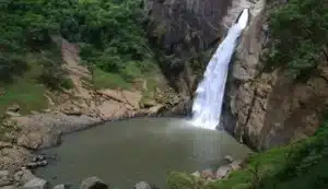
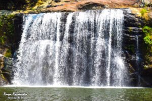
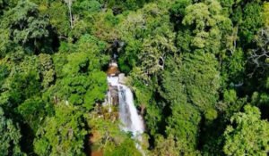
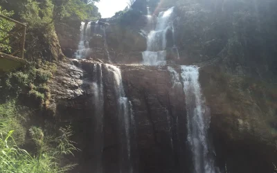
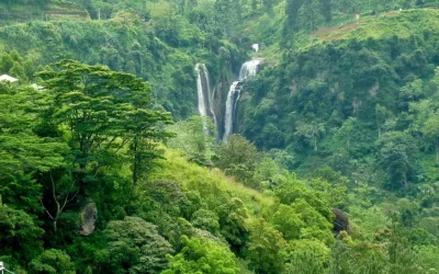
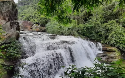
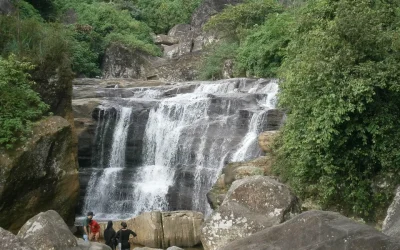
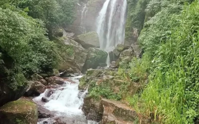
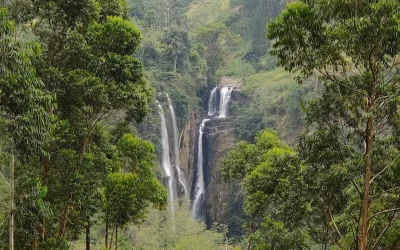
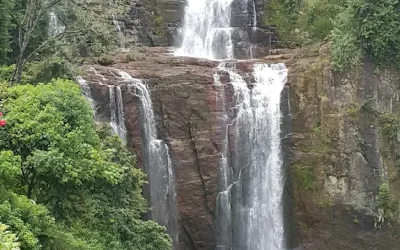
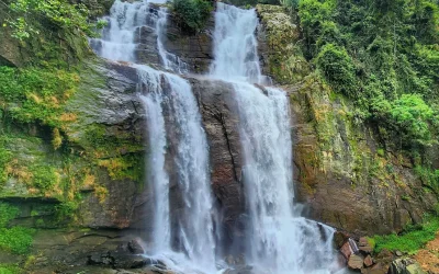
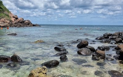
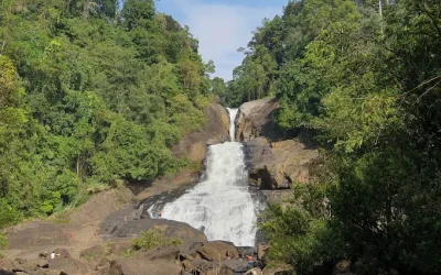
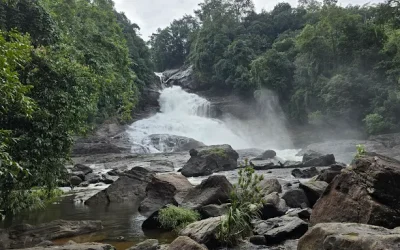
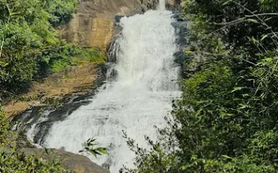
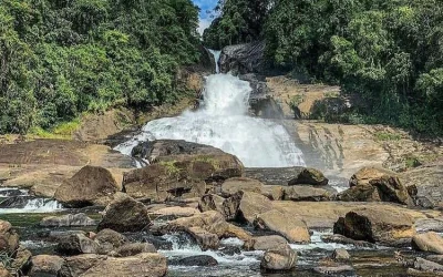
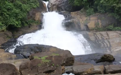
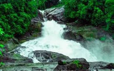
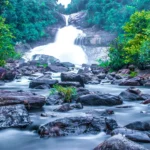
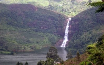
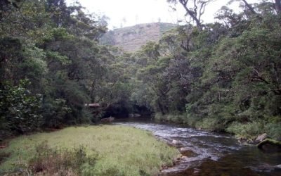
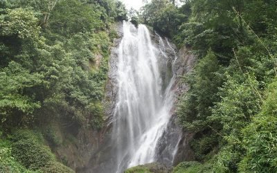
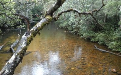
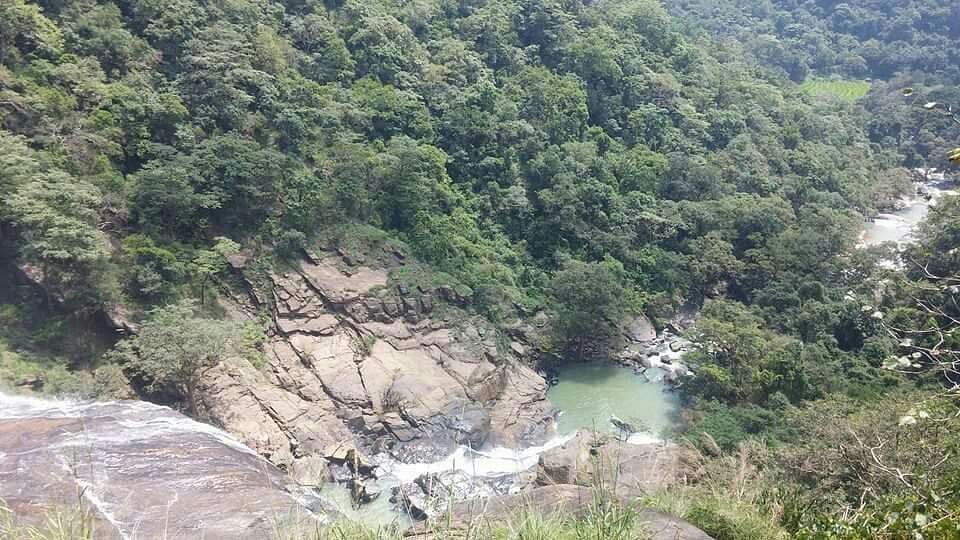
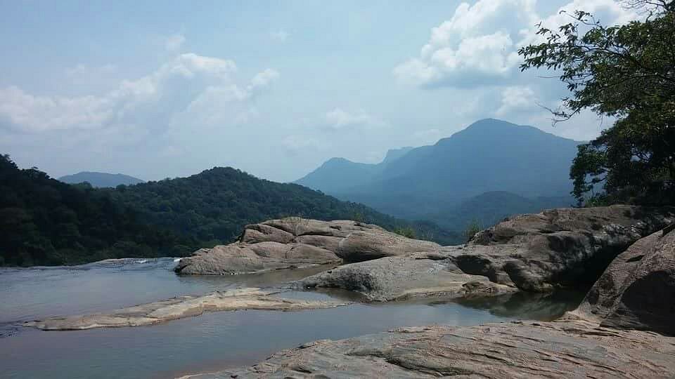
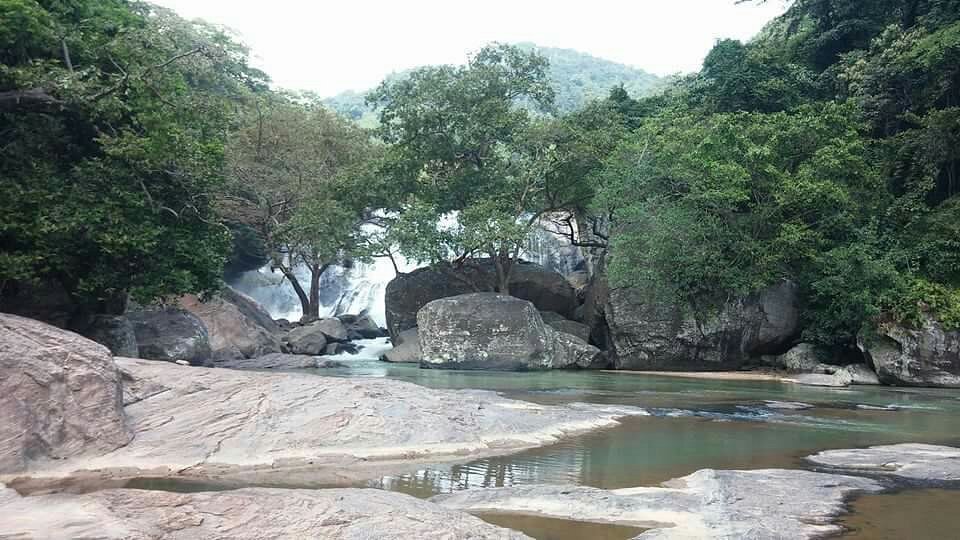
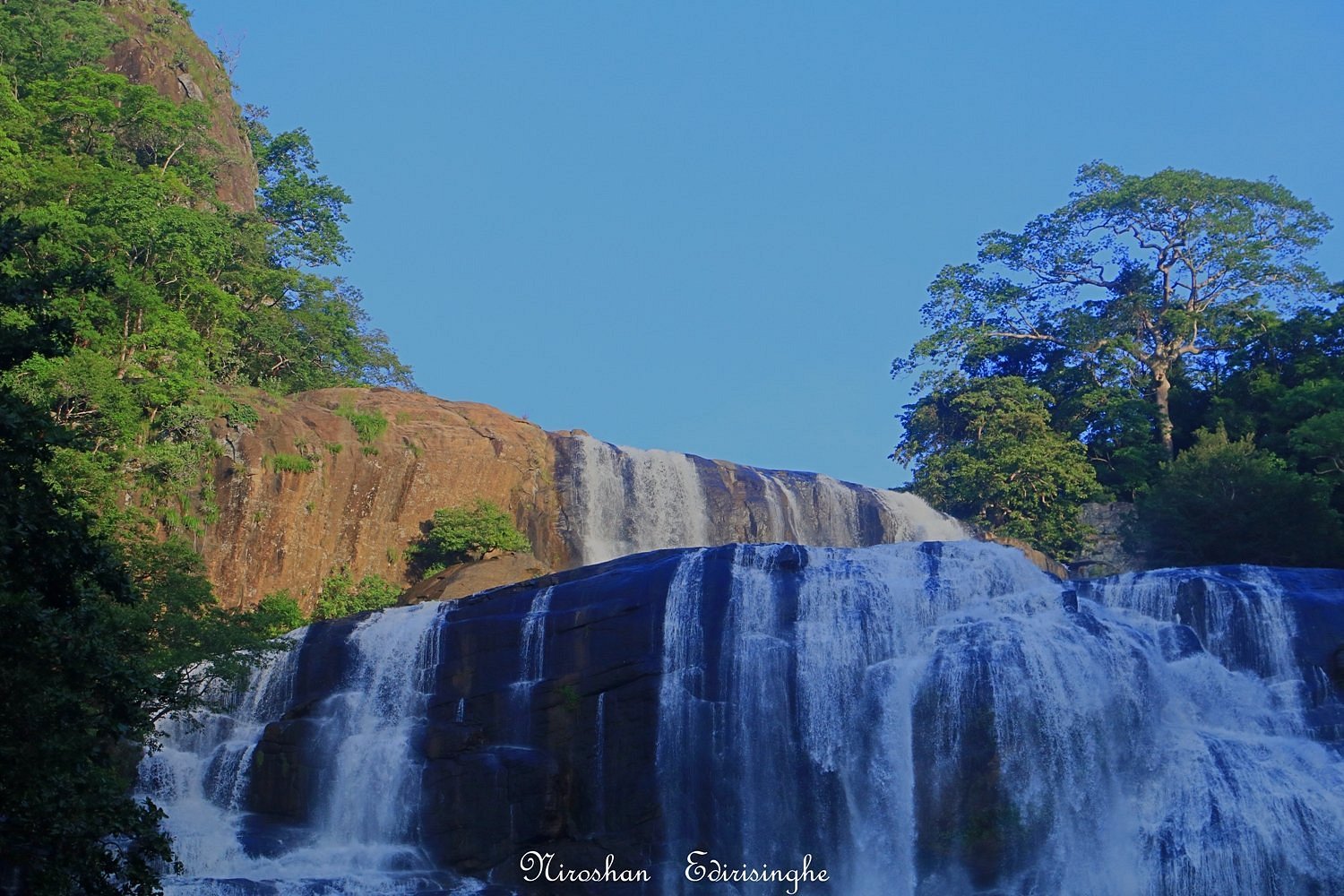
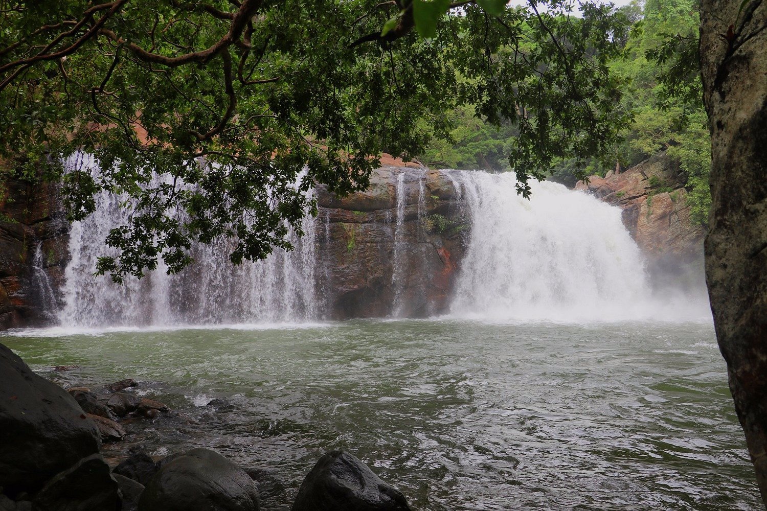
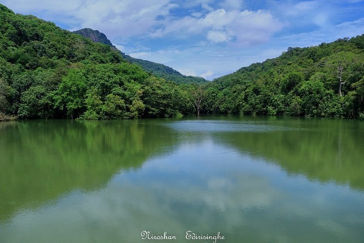
Rathna Ella (Gem Fall) is one of the widest and most beautiful waterfalls in Sri Lanka. It is located in the Hasalaka area, near the Knuckles Mountain Range. It is about 111 meters (364 feet) tall, making it the highest waterfall in the Kandy district. It is famous for its powerful flow and the green, wild forest that surrounds it.
If you like adventure and nature, Rathna Ella is a perfect spot.
✅ The “Widest” View: It is not just tall; it is very wide and grand. It looks like a giant white curtain falling down.
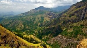
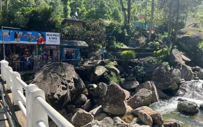
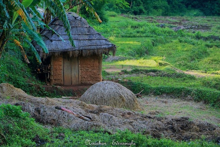
✅ Jungle Trek: To get there, you have to walk through a beautiful forest and green paddy fields. It feels like a real adventure.
✅ Hidden Gem: Unlike other famous waterfalls, this one is less crowded. It is quiet and peaceful.
↔️ Meaning: The name “Rathna Ella” means “Field of Gems.” Villagers believe there were seven pots of gems hidden near the fall!
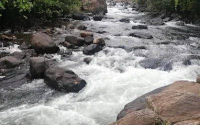
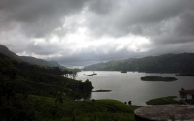
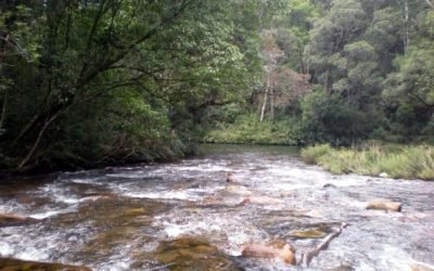
↔️ Water Source: The water comes from the Knuckles Mountain Range via the Hasalaka Oya.
↔️ Importance: This waterfall is very important for the local farmers. It provides water for the paddy fields (rice farms) in the village below.
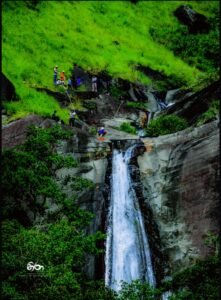
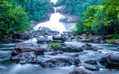
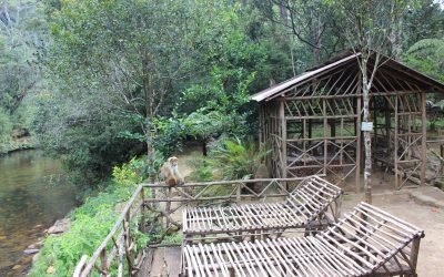
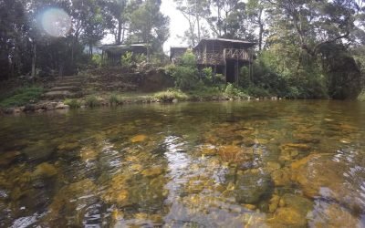
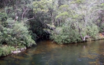
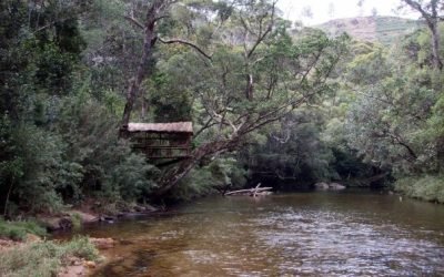
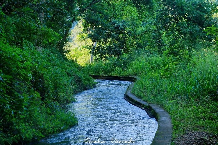
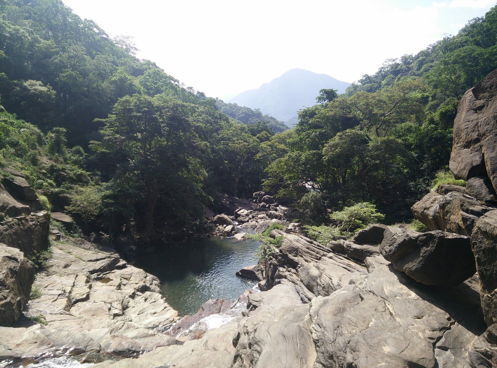
🌟 Hiking: Enjoy the 2-3 km walk from the village to the waterfall. The path goes along a small water canal.
🌟 Nature Photography: Take photos of the lush green trees, monkeys, and colorful butterflies you see on the way.
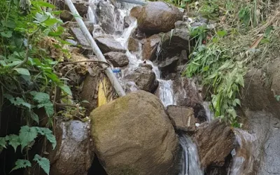
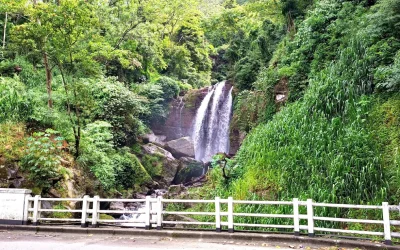
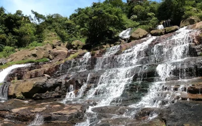
🌟 See “Kaluwa Watuna Ella”: On your way to Rathna Ella, you can see another smaller waterfall called Kaluwa Watuna Ella deep in the jungle.
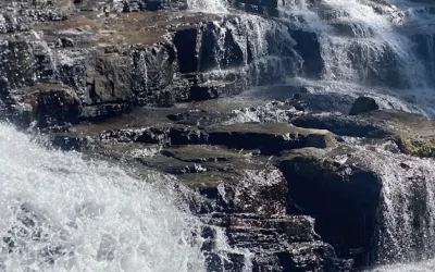
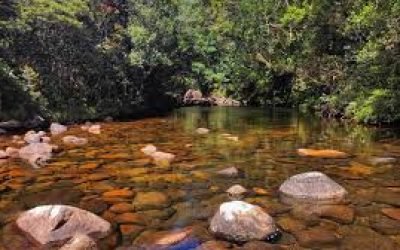
🌟 Relax: Sit by the rocks at the bottom (at a safe distance) and enjoy the cool spray of water.
Rathna Ella is located in Hasalaka, which is about 70 km from Kandy.
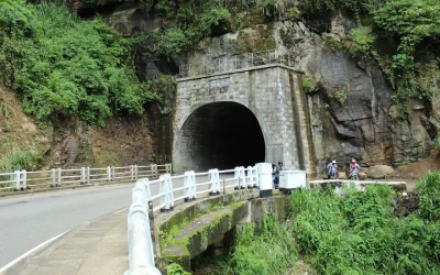
🚗 From Kandy: Take the Mahiyangana Road (A26). Go past the famous “18 bends” road until you reach Hasalaka town.
🚗 From Hasalaka: Travel about 2-3 km to the Rathna Ella village.
🚶 The Hike: From the village, you cannot drive to the waterfall. You must walk about 3 km along a footpath and a water canal to reach the base.
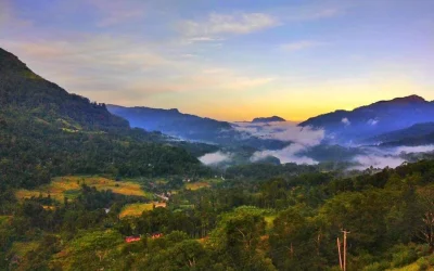
Visitors get a feeling of being in a lost world. The walk is very scenic with green rice fields on one side and tall trees on the other. When you finally reach the waterfall, the sound of the water is loud and powerful. It is a great place to forget your busy life and connect with pure nature.
⚠️ Wear Good Shoes: The path is long (about 1.5 hours walk one way) and can be muddy. Wear comfortable walking shoes.
⚠️ Bring Water: There are no shops near the waterfall, so bring your own water bottles and snacks.
⚠️ Leeches: Since it is a wet forest area, there might be leeches. Wear long socks or apply leech repellent.
⚠️ Safety First: Do not bathe near the main waterfall. The water is deep and the currents are very strong and dangerous.
⚠️ Start Early: Start your hike in the morning so you can return before it gets dark.
Rathna Ella is a true treasure for hikers and nature lovers. It requires a bit of walking, but the view at the end is worth every step. If you are near Mahiyangana or Hasalaka, do not miss this giant beauty hidden in the jungle!
රත්න ඇල්ල යනු ශ්රී ලංකාවේ ඇති ඉතාමත් පළල සහ සුන්දරම දිය ඇලිවලින් එකකි. මෙය නකල්ස් කඳු පන්තියට ආසන්නව, හසලක ප්රදේශයේ පිහිටා ඇත. මීටර් 111ක් (අඩි 364ක්) පමණ උස මෙම දිය ඇල්ල, මහනුවර දිස්ත්රික්කයේ ඇති උසම දිය ඇල්ල ලෙස සැලකේ. ඉතා වේගයෙන් ගලා එන ජල පහර සහ වටා පිහිටි ඝන කැලෑව නිසා මෙය සංචාරකයින් අතර ප්රසිද්ධියට පත්ව ඇත.
ඔබ වික්රමාන්විත ගමන්වලට (Adventure) සහ සොබාදහමට කැමති කෙනෙක් නම්, රත්න ඇල්ල යනු ඔබට කියාපු තැනකි.
✅ පළල දර්ශනය: මෙය උසින් පමණක් නොව, පළලින්ද වැඩි දිය ඇල්ලකි. එය හරියට යෝධ සුදු පැහැති තිර රෙද්දක් පහළට කඩා වැටෙන්නාක් මෙන් දිස්වේ.
✅ කැලෑව මැදින් යන ගමන: දිය ඇල්ල ළඟට යාමට වෙල් යායවල් සහ කැලෑව මැදින් පයින් යා යුතුය. එය සැබෑ වික්රමාන්විත අත්දැකීමකි.
✅ සැඟවුණු අලංකාරය: අනෙකුත් ප්රසිද්ධ දිය ඇලි මෙන් නොව, මෙහි සෙනඟ ගැවසීම තරමක් අඩුය. එනිසා නිස්කලංක බව අත්විඳිය හැකිය.
↔️ නමේ තේරුම: “රත්න ඇල්ල” යන්නෙහි අදහස “මැණික් ඇල්ල” යන්නයි. පැරණි ගැමියන් විශ්වාස කරන පරිදි මෙම දිය ඇල්ල අසල මැණික් මුට්ටි හතක් සඟවා ඇතැයි කියනු ලැබේ.
↔️ ජල මූලාශ්රය: දිය ඇල්ල නිර්මාණය වීමට ජලය ලැබෙන්නේ හසලක ඔය හරහා නකල්ස් කඳු පන්තියෙනි.
↔️ වැදගත්කම: මෙම දිය ඇල්ල ප්රදේශයේ ගොවීන්ට ඉතා වැදගත් වේ. පහළ ගම්මානයේ කුඹුරු ගොවිතැන් සඳහා ජලය සපයන්නේ මෙමගිනි.
🌟 පයින් ගමන් කිරීම (Hiking): ගමේ සිට දිය ඇල්ල දක්වා කිලෝමීටර් 2-3ක පමණ දුරක් කුඩා ඇළ මාර්ගයක් දිගේ පයින් යාමට ඇත. මෙම ගමන ඉතා සුන්දරය.
🌟 සොබාදහම ඡායාරූප ගැනීම: පාර දෙපස ඇති සුවිශාල ගස්, වඳුරන් සහ පාට පාට සමනලුන්ගේ ඡායාරූප ගැනීමට මෙය කදිම අවස්ථාවකි.
🌟 “කළුවා වැටුණ ඇල්ල” නැරඹීම: රත්න ඇල්ලට යන අතරමගදී කැලෑව තුළ පිහිටි තවත් කුඩා දිය ඇල්ලක් වන “කළුවා වැටුණ ඇල්ල” ද ඔබට දැකගත හැකිය.
🌟 විවේක ගැනීම: දිය ඇල්ල පාමුල ඇති ගල් තලාවක වාඩි වී (ආරක්ෂිත දුරකින්), ජල පහරේ හඬ අසමින් විවේක ගන්න.
රත්න ඇල්ල පිහිටා ඇත්තේ මහනුවර සිට කිලෝමීටර් 70ක් පමණ දුරින් පිහිටි හසලක ප්රදේශයේය.
🚗 මහනුවර සිට: මහියංගන පාරේ (A26) පැමිණෙන්න. ප්රසිද්ධ “දහඅට වංගුව” පාර පහු කර හසලක නගරයට එන්න.
🚗 හසලක සිට: එතැන් සිට කිලෝමීටර් 2-3ක් පමණ දුරින් පිහිටි රත්න ඇල්ල ගම්මානයට එන්න.
🚶 පයින් ගමන: ගම්මානයේ සිට දිය ඇල්ල ළඟටම වාහනවලින් යා නොහැක. එතැන් සිට කුඹුරු සහ ඇළ පාරක් දිගේ කිලෝමීටර් 3ක් පමණ පයින් යා යුතුය.
නරඹන්නන්ට වෙනම ලෝකයක අතරමං වූවා වැනි හැඟීමක් මෙහිදී ලැබේ. ගමන පුරාවටම එක පැත්තකින් හරිත පැහැති කුඹුරු යායවල් ද, අනෙක් පැත්තෙන් යෝධ ගස් ද ඇත. දිය ඇල්ල ළඟට ගිය විට ඇසෙන ජල පහරේ ගාම්භීර හඬ ගත සිත පුබුදුවාලයි. කාර්යබහුල ජීවිතයෙන් මිදී සොබාදහම සමඟ තනි වීමට මෙය කදිම තැනකි.
⚠️ සුදුසු පාවහන්: පයින් යන පාර තරමක් දුර (පැය 1.5ක් පමණ එක පැත්තකට) සහ මඩ සහිත විය හැකි නිසා, ඇවිදීමට පහසු සපත්තු පළඳින්න.
⚠️ ජලය රැගෙන යන්න: දිය ඇල්ල අසල කඩ සාප්පු කිසිවක් නොමැති බැවින්, අවශ්ය පානීය ජලය සහ කෙටි කෑම ඔබම රැගෙන යන්න.
⚠️ කූඩැල්ලන්: මෙය තෙතමනය සහිත කැලෑවක් නිසා කූඩැල්ලන් සිටිය හැකිය. දිග මේස් දැමීම හෝ කූඩැල්ලන්ගෙන් ආරක්ෂා වීමට බෙහෙත් වර්ගයක් (Siddhalepa/ලුණු වතුර) භාවිතා කරන්න.
⚠️ ආරක්ෂාව: ප්රධාන දිය ඇල්ල අසල දිය නෑමෙන් වළකින්න. එහි ජලය ඉතා ගැඹුරු වන අතර දිය යට ප්රවාහය (Current) ඉතා සැර සහ අනතුරුදායකය.
⚠️ වේලාසනින් යන්න: අඳුර වැටීමට පෙර ආපසු ඒමට හැකි වන පරිදි උදෑසනින්ම ගමන පටන් ගන්න.
රත්න ඇල්ල යනු පයින් ඇවිදීමට කැමති අයට සහ සොබාදහමට ආදරය කරන අයට ලැබෙන වටිනා තෑග්ගකි. ටිකක් මහන්සි වී පයින් යාමට සිදු වුවද, ගමන අවසානයේ දකින සුන්දර දසුන ඔබේ සියලු මහන්සිය නිවා දමනු ඇත. ඔබ මහියංගනය හෝ හසලක පැත්තේ යනවා නම්, කැලෑව ඇතුළේ සැඟවුණු මෙම යෝධයා දැක බලා ගැනීමට අමතක කරන්න එපා!


There are no results matching your search
“Please note: Distance calculations may slightly differ from the actual distance. Kindly confirm the route before you begin your journey.”

233 Places Hosted
SL Traveler

There are no results matching your search
“Please note: Distance calculations may slightly differ from the actual distance. Kindly confirm the route before you begin your journey.”
“All the credits for Videos, Images & contents goes to respective owners.”
The content on this website, including images and videos, is sourced from various third parties. We do not claim ownership unless stated. If you believe your rights are violated, please contact us at dayoutbook@gmail.com. You can also click on the above “Claim” button to submit a ticket and briefly mention your details and concerns for immediate action. We will promptly credit, modify, or remove the content as necessary.
Use of this website is at your own discretion and risk


There are no results matching your search

The content on this website, including images and videos, is sourced from various third parties. We do not claim ownership unless stated. If you believe your rights are violated, please contact us at dayoutbook@gmail.com. We will promptly credit, modify, or remove the content as necessary. Use of this website is at your own discretion and risk.
See full Disclaimer for more info
© 2025 – All Rights Reserved. Made by Dayoutbook Team


